A
Allegheny, Ohio country
B
Bethlehem, Pennsylvania, named by Count Ludwig von Zinzendorf on Christmas Eve 1741, was the center of Moravian mission activities to the Native Americans in the American colonies.
Blue Mountain, Second Mountain is at Lorberry Junction, Swatara Creek.
C
Canaserage, a Shawnee and Chickasaw village on the West Branch at the mouth of the Muncy Creek. This was the line that the Five Nations demanded should not be crossed in the land purchases of the 1750s. In 1755 Conrad Weiser held a conference here, with 20 representatives of the Native American nations; six of these warriors were Chickasaw. Plants grown here were used for medical purposes by the Indians.
Chillisquaque Creek, site of a Shawnee village, name means “place of the snowbirds.” It was a stop along the Great Shamokin path, located upstream from Shamokin on the West Branch of the Susquehanna River.
D
Danesbury, today, East Stroudsburg, Pa on the Pennsylvania/New Jersey border.
E
Eva Creek, today Shamokin Creek, just south of Shamokin (Sunbury).
F
French Margaret’s Town, see also Quenisheshaque, today Williamsport, named after French Margaret, daughter or niece of Madame Montour and wife of the Indian Peter Quebec. Margaret prohibited the use of rum in her village, which was a widespread custom among the Native people. She was also politically active, attending many treaty meetings with Conrad Weiser and Shikellamy.
G
Gnadenhütten; Moravian mission on the Mahoning and Lehigh rivers, in today’s Lehighton. “Gnadenhütten” (cabins of grace) was founded in 1746. It was established as a mission to the Lenape by Moravians from Bethlehem, Pennsylvania, lower on the Lehigh River. During the French and Indian Wars (Seven Years’ War), Native allies of the French killed 11 missionaries and Lenape (Delaware) converted Christians at Gnadenhütten on 24 November 1755. They destroyed the mission village, and only four of the fifteen residents escaped.
Great Island or Mechek-menatey or Cawichnowane (Lewis/Evans map), an important gathering place near Lock Haven for the Iroquois where many paths converged. It was a convenient location for councils and camping. These paths lead to places such as the Alleghany River, the Juniata River, and Lycoming Creek. The soil on this 325 acre area of land was extremely fertile, which provided a good location for the Indians to plant corn.
H
Harris’ Ferry, at present-day Harrisburg was the closest ferry to Shamokin across the Susquehanna river.
Heidelberg, Pa, Berks County
Hockhocking, known as French Margaret’s Town, on the headwaters of the Hocking River at what is now Lancaster, Ohio.
I
J
Jacobs Höhe, (Jack’s Mountain?)
K
Königsberg, the first mountain south of Shamokin, today it is called Little Mountain.
L
Lancaster, Pa, was part of the 1681 Penn’s Woods Charter of William Penn, and was laid out by James Hamilton in 1734.
Lebanon, PA, settled by European colonists in 1720, many with the family names of “Steitz” and “Light”, along a creek that was then named “Steitz Creek”.
Long Island, in the West Branch of the Susquehanna River, today Jersey Shore, Pa
Ludwig’s Ruh, frequent night camp on the Tulpehocken Path, today near Hegin’s Pa
M
Macungie, PA derived from “Maguntsche”, a place name used as early as 1730 to describe the region that is now Macungie and Emmaus, Pennsylvania. “Maguntsche” is a Lenape word, meaning either “bear swamp” or “feeding place of the bears”.
Meniolagomekah, an Indian town in Monroe County, eight miles south of Wind Gap. The Indians were removed from this village in April 1754 to Gnadenhütten on the Mahony at the request of the white owner of the land, Richard Peters, who wanted the area cleared of Indians (see Donehoo, p. 107).
Mennissing, now Minisink, Ulster Co., NY
Moncleir Bank, see Wapwallopen
Monocacy in Maryland, located near present-day Creagerstown in Frederick County, Maryland
N
Nescopeck, on the North Branch of the Susquehanna.
O
Oley, Berks County, PA, location of the Moravian Church and School building, built about 1742. It was used by the Moravians as a school from 1742 until 1776.
Onondago, home of the council fire of the Six Nations of the Haudensosaunee, near present-day Nedrow, NY
Ostonwakin, PA, (today Montoursville) known as Isabelle Montour’s village, visited by Zinzendorf in 1742, but abandoned by the late 1740s.
P
Philadelphia, PA, seat of the Colonial government
Q
Quenisheshaque, also known as French Margaret’s Town, on the west branch of the Susquehanna at the mouth of Lycoming Creek (now Williamsport, Pennsylvania).
Quitapahilla, a branch of the Swatara Creek in Lebanon County. This trail between present-day Reading, Tulpehocken and Shamokin was frequently used by Weiser, Cammerhof, and also Shikellamy and Teedyuskung on their way to Councils in Philadelphia. For a detailed description of the trail, see Cammerhof’s Journal of 1748, Pennsylvania Magazine of History and Biography, 29 (1905): 160-179.
R
S
Schoharie, Shohari, Sgochari, upstate New York, south-west of Albany.
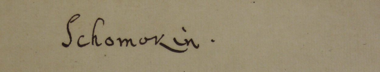
Shamokin, Pennsylvania, today Sunbury. Shamokin was a central point where many Indian paths converged, making it a popular gathering place. Shikellamy, the Oneida Viceroy of Shamokin, was said to have lived here when sent by the Iroquois Confederacy to perform governing duties. Both Indians and settlers resided here in peace until conflict rose over Iroquois hunting grounds. The attack on settlers at Penn’s Creek in 1755 caused further unrest and tension. The Indians abandoned the town in 1756. It then became the site of Fort Augusta and later Sun
Shamokin Creek, a tributary of the Susquehanna River, that flows into the main stem just south of Sunbury
Shamokin Island, now Packer Island, lies in the North Branch of the Susquehanna River between present-day Sunbury and Northumberland. It is the site of the Shikellamy State Park Marina. According to Canasetego in 1736, Shamokin Island was one of the two designated places in the province remaining for the Delaware. See Anthony Wallace, King of the Delawares: Teedyusung 1700-1763 (Syracuse: Syracuse University Press, 1949) 37.
Shekomeko, NY
Spitzberg, mountain near Shamokin
T
Teockhansoutehan, French Indian town
Thürnstein, Mahantango or Pete’s Mountain
Tioga,
Tulpehocken, site of Womelsdorf, Conrad Weiser’s home. Frequent stop on the journey to Shamokin
U
V
W
Wahochquage, poss. Oquaga, Ouaquage, Broome Co., N.Y.
Wapwallopen, PA, Womphallepang, “white hemp place,” site near Council Cup, Big Bend. Two Indians from here were converted by Moravians: Gottlieb and Mary were baptized in Bethlehem in 1745. According to Donehoo, this place, marked on Scull’s (1759) and Evan’s (1755) maps as “Indian Town” marks the spot where the Indian path from the Great Island (Lock Haven) met up with the Indian path heading to Wyoming. (Donehoo, p. 247-8).
Wyoming, PA, The name derives from the Lenape Munsee name meaning “at the smaller river hills.” According to the Jesuit Relation of 1635, the Wyoming Valley was inhabited by the Scahentoarrhonon people, an Iroquoian-speaking group; it was then known as the Scahentowanen Valley. By 1744 it was inhabited by Lenape, Mahican, Shawnee and others who had been pushed out of eastern areas by the Iroquois Confederacy. From the 1740s to the 1760s, the valley was the site of Moravian mission work among the Native Americans living there. They envisioned a settlement for Christian Indians and the replacement for the blacksmith’s shop that was built at Shamokin. But the violence of the French and Indian War, the North American front of the Seven Years’ War, drove the Moravians away.
X
Y
Z